001 : Academic Works
As a student at Universitas Gadjah Mada, I pursued a Diploma 3 and an Applied Bachelor’s Degree in Geographic Information Systems. I graduated in February 2023 with a GPA of 3.73. These are some of my academic works, including my final projects for both programs:
1. Estimation of Carbon Absorption by Plant Biomass Using Sentinel-2 Images (Case Study: Yogyakarta City)
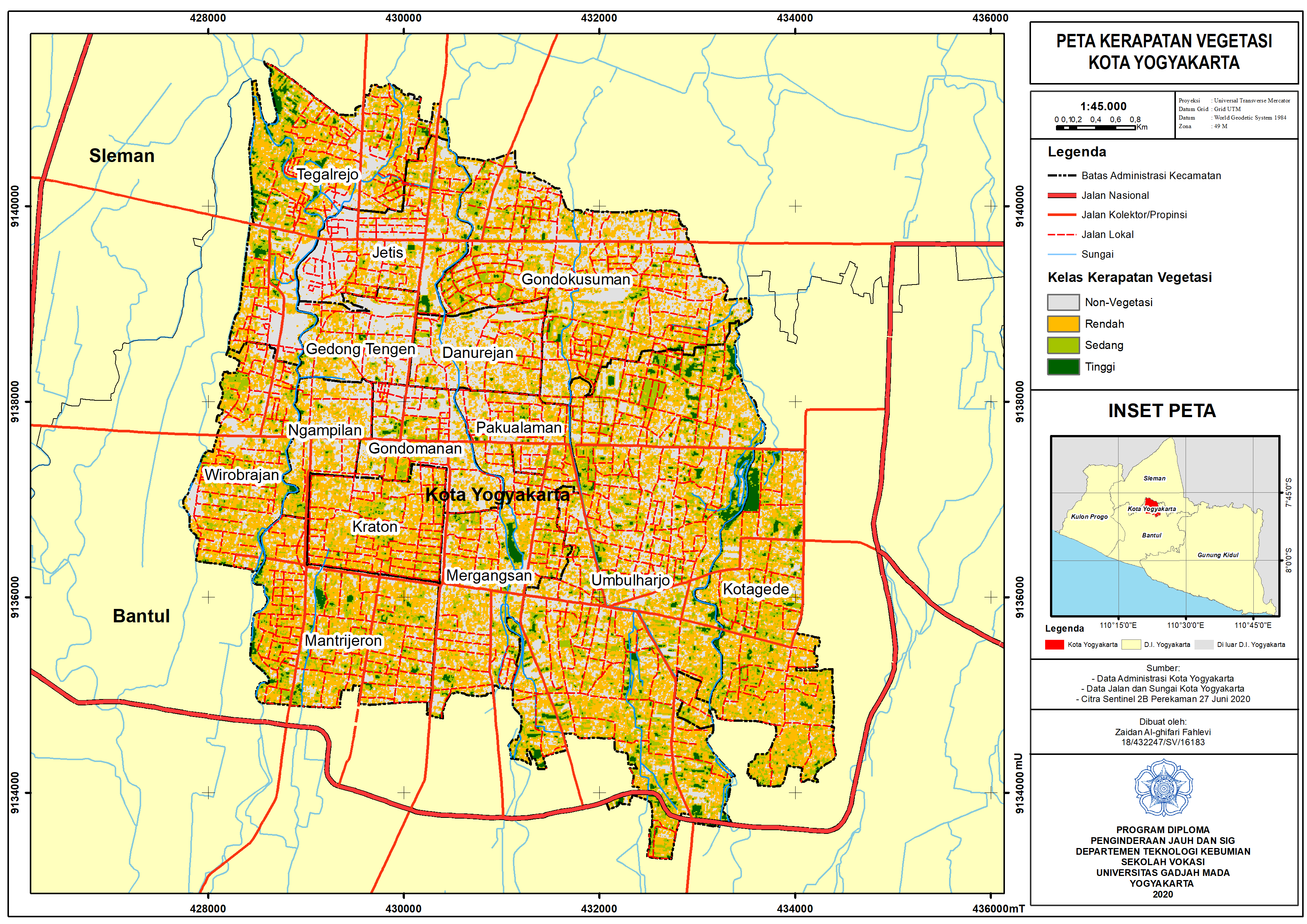
Vegetation Density Map
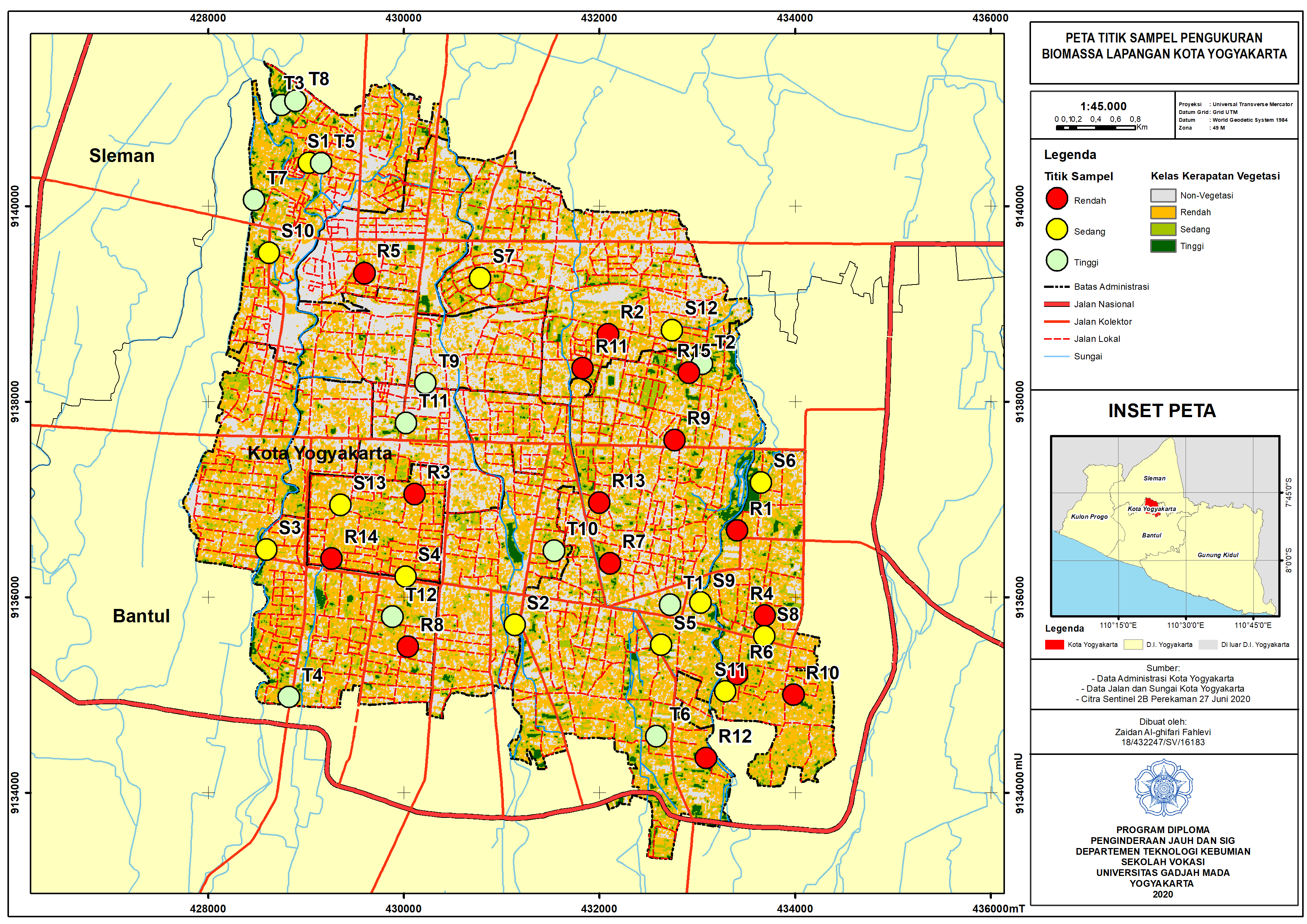
Sample Point Map
The increasing human activities on the earth's surface contribute to significant greenhouse gas emissions in the atmosphere, leading to temperature changes. Changes in land use from green spaces to residential or industrial areas are a primary source of these emissions, especially in urban regions. Plants, with their biomass, play a vital role in absorbing carbon—the largest component of greenhouse gases in the atmosphere. This study aimed to estimate carbon absorption by plant biomass in Yogyakarta City, a region vulnerable to land conversion due to rapid population growth. The research utilized Sentinel-2 imagery, with biomass distribution derived from regression analysis between NDVI (Normalized Difference Vegetation Index) and field biomass measurements.
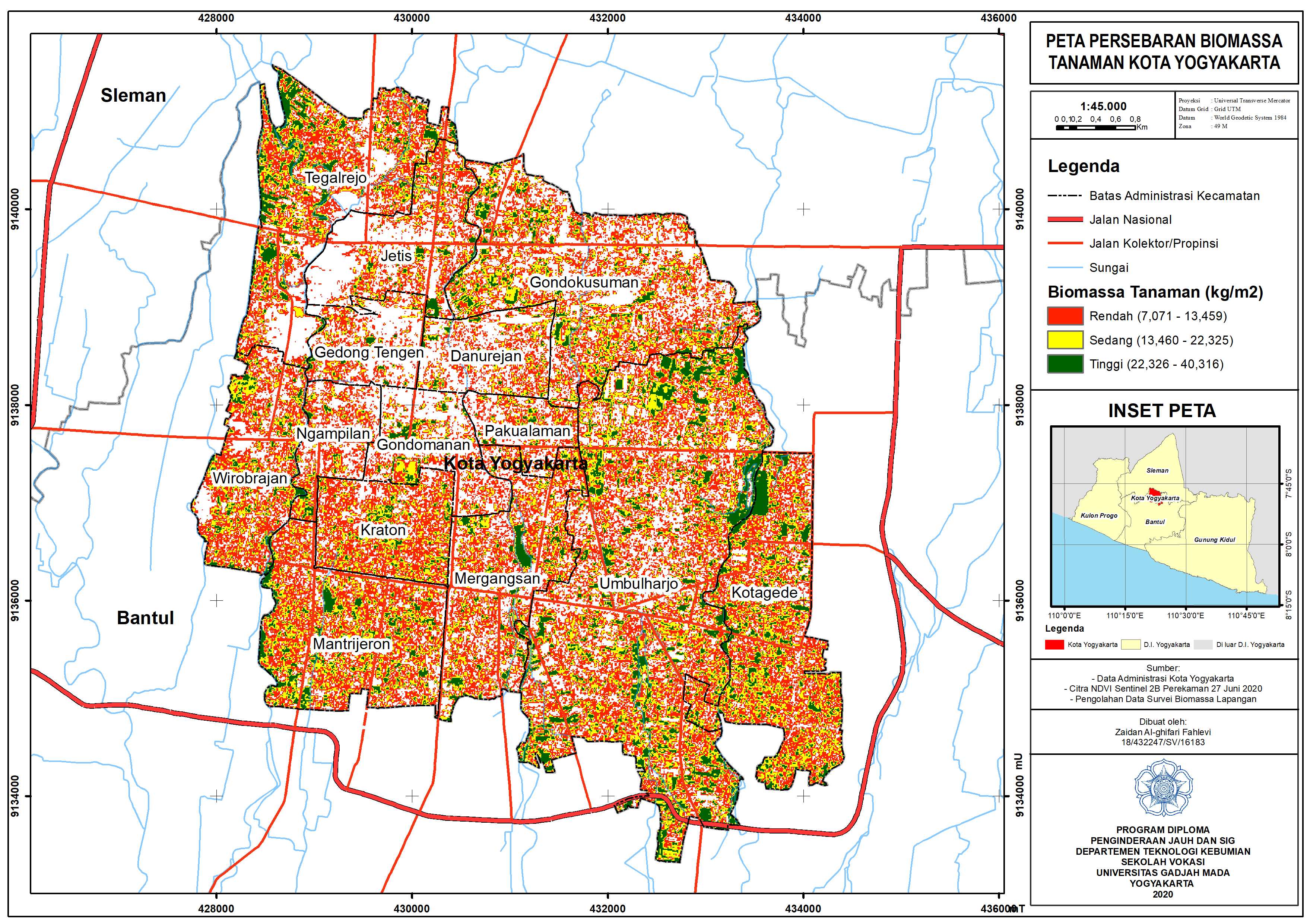
Biomass Distribution Map
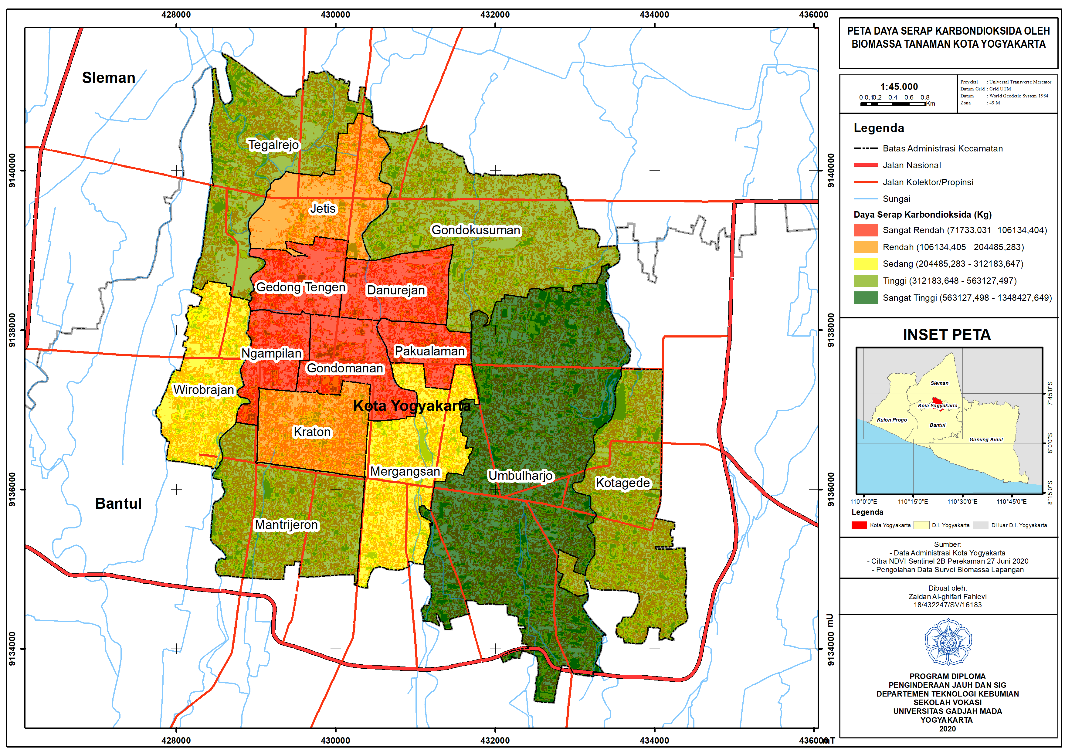
Carbon Absorption by Plant Biomass Map
This regression equation demonstrates a positive linear relationship between the NDVI values (as the independent variable) and the measured field biomass (as the dependent variable). Higher NDVI values indicate denser vegetation, leading to greater biomass estimates. By applying this model, the distribution of plant biomass was classified into three categories (low, medium, high), and carbon absorption was further calculated using a biomass-to-carbon conversion coefficient (1.47). This approach provides a systematic method to estimate and spatially distribute biomass and carbon absorption across Yogyakarta City.
Biomass Classes:
The study estimated the total carbon absorption capacity of plants in Yogyakarta City at 4,712,848.656 kg. This research provides essential insights for urban planning and sustainable land use management.
You can access this final project on ETD here: ETD
------
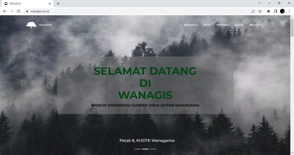
2. WANAGIS (WANAGAMA WebGIS): WebGIS Dissemination of Forest Resources in Wanagama
WANAGIS
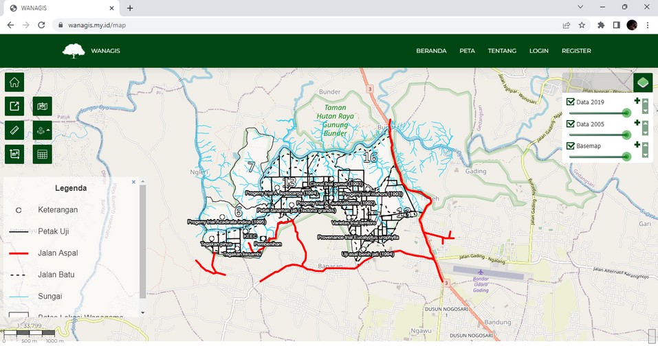
Map View - WANAGIS
WANAGIS is a WebGIS developed for the dissemination of forest
resource data in Wanagama, a Special Purpose Forest Area managed
by Universitas Gadjah Mada. Wanagama serves multiple purposes,
including reforestation, education, nature tourism, and
community events.
Development Tools and Technologies:
Features of WANAGIS:
The user-friendly interface was designed with a user-centered approach to enhance accessibility and usability. WANAGIS displays forest resource data, such as plot boundaries, slope, soil type, land cover, roads, rivers, and infrastructure.
Significance: WANAGIS optimizes the dissemination and utilization of forestry data, supporting sustainable forest management in Wanagama.
You can access this final project on ETD here: ETD
------
3. Analysis of Land Deforestation in Sintang Regency (2009-2021)
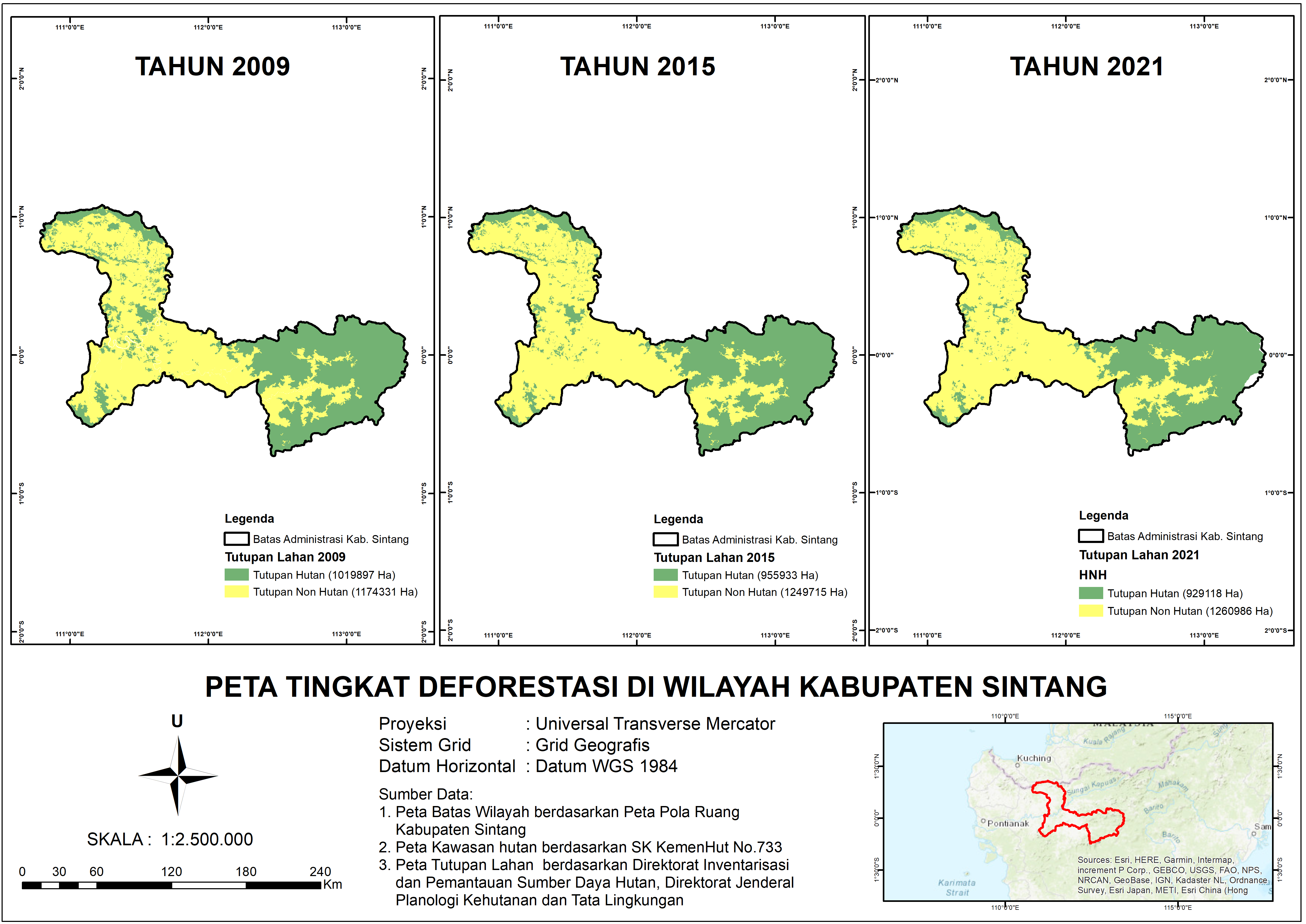
Peta Tingkat Deforestasi di Kabupaten Sintang
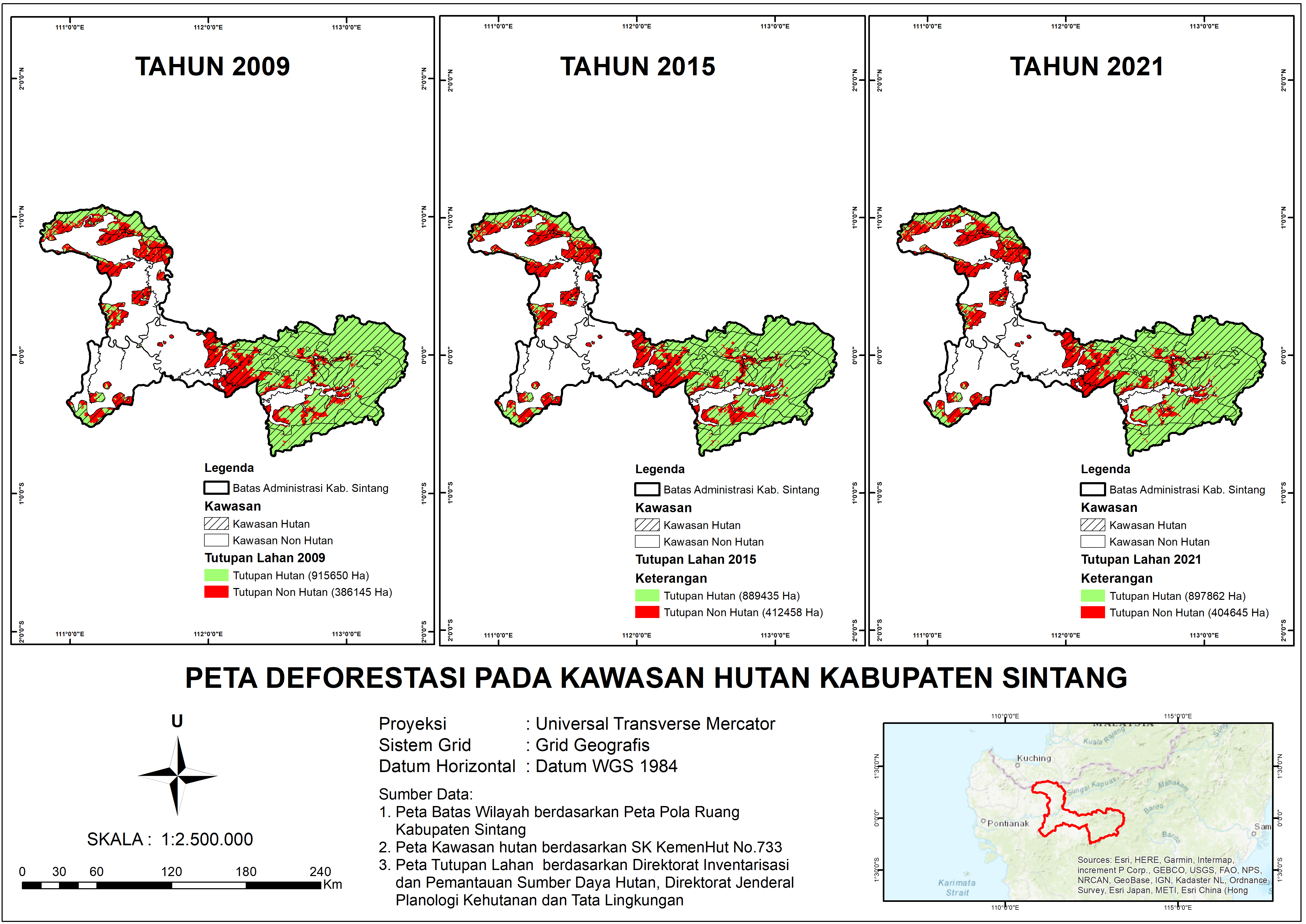
Peta Deforestasi pada Kawasan Hutan di Kabupaten Sintang
Sintang Regency faces significant challenges due to increasing deforestation driven by land-use changes. This study, conducted during an internship at Karomap Semesta, analyzed deforestation trends to measure forest cover changes from 2009 to 2021.
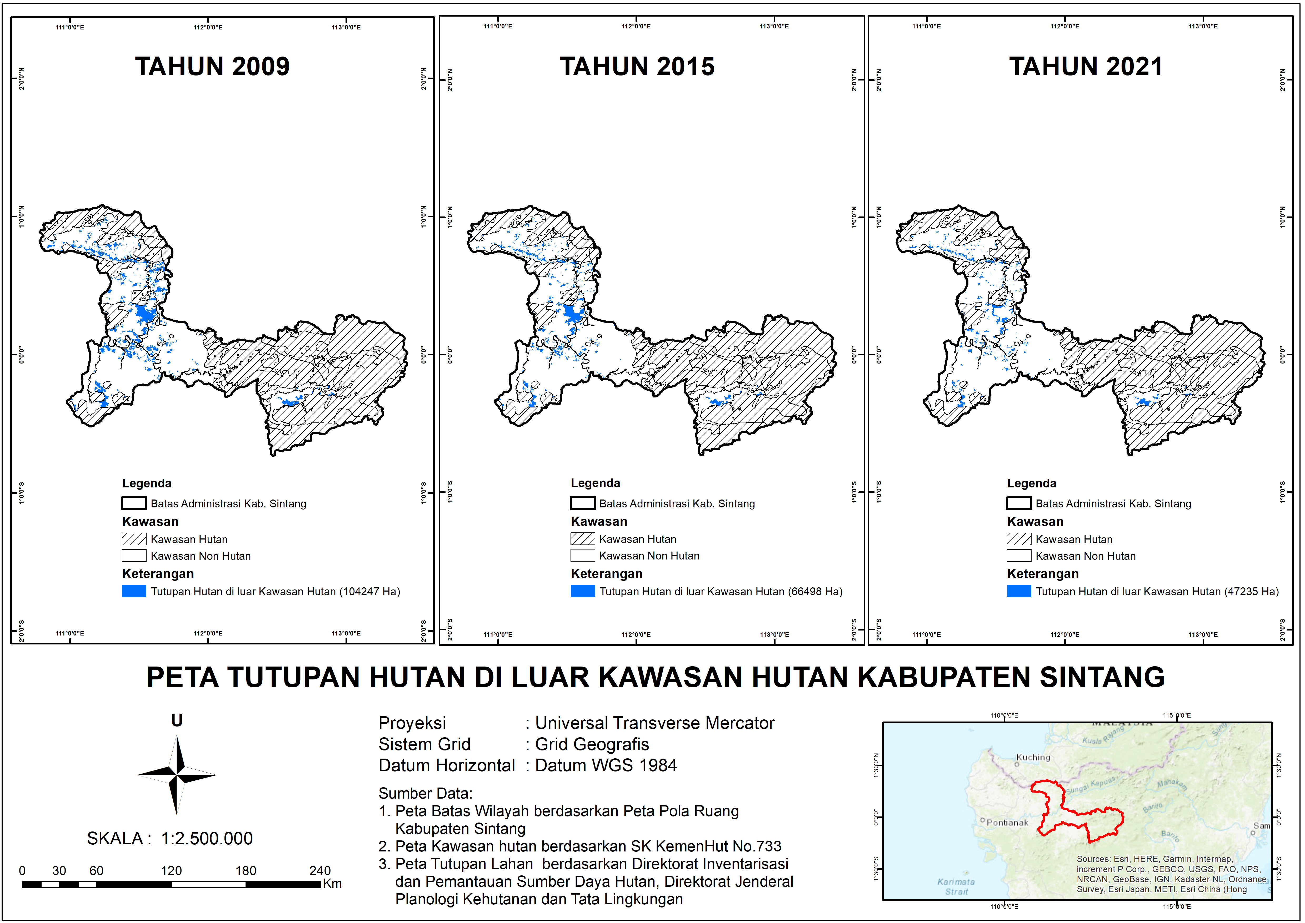
Peta Tutupan Hutan di Luar Kawasan Hutan Kabupaten Sintang
Findings:
- Conversion to plantations: 38.19%
- Dryland farming mixed with shrubs: 32.71%
- Shrubland: 18.56%
- From 1,019,897.34 hectares (2009) to 929,117.65 hectares (2021), a 4% reduction.
Challenges: Although reforestation efforts covered 25,137 hectares (19,926 hectares in forest zones), they remain insufficient to counteract the rapid rate of deforestation. Effective land management and environmental rehabilitation are urgently needed to minimize long-term impacts.